13.2.1 Description of the Study Area
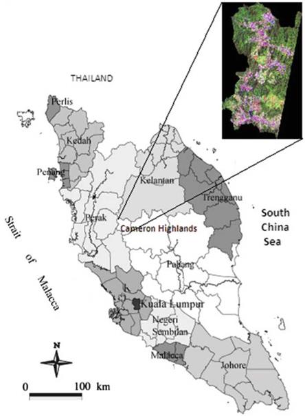
The study area covers the western region of the Cameron Highlands district, State of Pahang, Peninsular Malaysia (Fig. 13.2). The area is located between 4°35’55.40"N and 101°29’07.05"E, and about 200 km from Kuala Lumpur City and only 120 km from Ipoh City in Perak state. The study area covers an area of about 27,009.8 ha from the total area of the Cameron Highlands district (71,225 ha). Elevation in the study area ranges between 1,070 m and 1,830 m above mean sea level. The highland has steep slopes; 66 % is more than 20° slope. The mean
|
Fig. 13.2 Location and satellite imagery (inset) of Cameron Highlands, Peninsular Malaysia |
temperature is about 24 °C in daytime and 14 °C at night. The average annual rainfall is 2,660 mm with two peaks in May and October. Cameron Highlands is drained by three main rivers, namely, Sg. Telom, Sg. Bertam, and Sg. Lemoi. Two of the main economic activities in Cameron Highlands are tourism and agriculture.
|
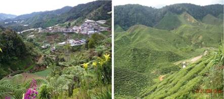
Fig. 13.3 The Cameron Highland’s view of forests, farms, terraces, homes, and tea plantation |
Popular as an agrotourism spot in Peninsular Malaysia, the landscapes of the highlands are covered by natural forests, orchards, vegetable farms, flower terraces, and nurseries (Fig. 13.3). Some of the flora and fauna in these highlands are considered as rare or endemic and are totally different from lowland vegetation types. The forests above 1,500 m are known as the upper mountain forests and are found on mountain summits and ridges on the western borders of this area. The lowland dipterocarp forest ranges from 300 m and above and mainly on the eastern part of the district. This highland is known to contain a diverse array of plant species and is very biodiverse, with many species that are restricted to mountains and highlands. Thus, the ecology of Cameron Highlands is extremely fragile and sensitive to disruption.


