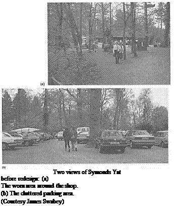
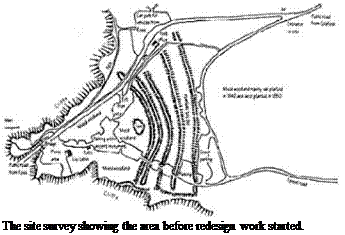
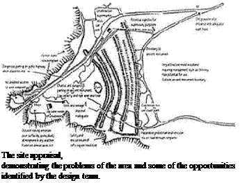
The managers felt it was imperative that a completely fresh look was given to the area. The brief was simply to improve the quality of experience for the 400 000 visitors and to protect and enhance the scheduled ancient monument and the surrounding woodland. This implied that the facilities should be expanded to cater for the existing demand but that no increase should be catered for. The site and its surroundings, the highways and nearby communities had reached saturation point.
A team was assembled to carry out the task of design and implementation, work being phased over two periods. The team consisted of a landscape architect, the local forester for the area, the land agent responsible for land use, a civil engineer and a building surveyor. Together they collected information, analysed the site and proposed design ideas. Consultation was and remains an important process with local communities, the planning, highway and drainage authorities, English Heritage—who are responsible for the ancient monument— and English Nature, as the site is important for nature conservation.
The survey showed that existing parking was inadequate. It was located partly within the ramparts of the fort and inside the ancient monument. Access to and from the public road was difficult, especially the exit that existed at that time. However, there was an area of mature woodland to the south, outside the monument yet near to the site
focus, which offered the prospect of better parking. In fact most facilities, including a bigger toilet block, could be placed here and so protect the monument.
 |
In view of the desire to limit the number of visitors to the existing level, the analysis suggested that some 200 parking spaces were needed. This included coach parking, and an area dedicated to visitors with disabilities, to be located nearest to the entrance to the focus of the main site. To cater for peak numbers an overflow car park of 50 spaces was also allowed for. Vehicle
circulation, in particular the entrance and exit, had always been a problem. Analysis of possible alternative access points showed that there was none nearby. The gradients and the sightlines of the highway did not permit any. Instead, the radical idea of developing a new access road-cum-scenic drive to a safer and more distant exit point was conceived. This had the immediate effect of streamlining the vehicle circulation on site, reducing congestion on a narrow public highway, increasing safety for everyone, and reducing the overall amount of traffic passing nearby houses.
 |
Once the traffic circulation was sorted out, the parking layout needed to be designed. Rather than have a single area of parking concentrated in one place it was felt that a more dispersed arrangement was desirable. There was sufficient space to accommodate dispersion in the area, and this also reduced the need to clear completely an area of the forest. The layout keeps a main flow from entrance to exit in a one-way direction. Off the main flow there are
several branches, each with parking bays along either side. These link to a secondary one-way exit route, which meets the main route near the entrance to the overflow parking. A separate coach parking loop allows passengers to be dropped close to the main footpath, while drivers with disabilities or cars with passengers with disabilities can park in their own special area near the focus of the site.
 |
As passengers leave their cars, simple clear signs direct them towards the main focus of the site. Here there is a large toilet block, with sufficient capacity to cope on the busiest days; some information and orientation about the site; some picnicking; the start of the main path to the viewpoint; and the entrance to a second forest trail. People then move along a wide, smooth path, made from the former car park area, towards the focus. The old car park has been reinstated
to grass in places, and the road has been narrowed to allow vehicular access to service the existing shop and for emergency purposes.
Within the old fort the new design has removed the old toilet block, refurbished the log cabin souvenir shop, provided an information point, and laid out picnic furniture and benches. As the site is a scheduled ancient monument it is not possible to excavate, and so the new furniture has to sit on the ground surface without anchorage. Designs were developed that are too heavy to be easily lifted or stolen. Some parking for people with disabilities was retained in part of the old parking area, and a small toilet block for them was added to the rear of the shop.
The main viewpoint is reached by crossing a footbridge over the public road and following a boardwalk and trail. This had to be regraded and resurfaced to allow for wheelchair access. The eroded viewpoint was infilled with compacted crushed stone.
At the viewpoint the main attraction all year round is the dramatic focal view of the River Wye gorge falling steeply below the Yat Rock. Also of interest is the sight of peregrine falcons nesting in the rock face of the gorge opposite the viewpoint. Telescopes are available for close-up viewing of these rare birds, while volunteers watch them around the clock to deter would be egg thieves. There are also some interpretative panels at the viewpoint.


