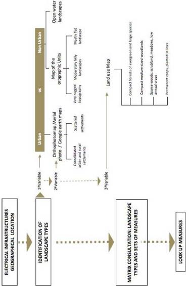
Landscape is something very complex and variable that, in the Portuguese context, is heavily accentuated by the geographic location, the orographic variety of the country, and by the interaction of various ecological factors leading to a really rich and diverse landscape. This makes it advisable to attempt to identify homogeneous areas from the point of view of their character which is reflected in different types of landscape. The method developed for the identification of the types of landscapes, within this Manual, refers to a process of sequential selection of the main variables of the landscape, which ought to be considered as more relevant to landscape integration of electrical infrastructures: degree of urbanization, orography, and vegetation cover (figure 2).
|
Fig. 2. Conceptual Framework for the consultation of the Manual |
At first, two situations were distinguished which, by their nature, bring very different conditions: ‘urban areas’ and ‘non-urban areas’, i. e. landscapes dominated or not dominated, respectively, by the territory construction and infrastructure. Indeed, the urbanization of the territory and the consequent infrastructures introduce a significant artificiality that results in landscapes with a distinct character that encompass a very specific approach. ‘Urban areas’ are also landscapes where people stay longer, which means that social issues about the quality of the places where they live, work and enjoy themselves, must be taken into account.
Consequently, for what was named ‘urban areas’ two types of landscape were identified – (1) consolidated urban and rural settlements and (2) scattered settlements. This classification was defined taking into account the degree of urban consolidation, which is reflected into a higher or lower unity/density/continuity of built space. The first case presents a significant degree of consolidation while in the second case the level is low.
Since one of the aims of this process is to ensure ease of use and the application of this technical manual for non-specialists in the field of landscape, ‘identification guides’ were developed, using either illustrative processes or descriptive processes, to facilitate the procedures of identifying the type of landscape where an infrastructure will be placed.
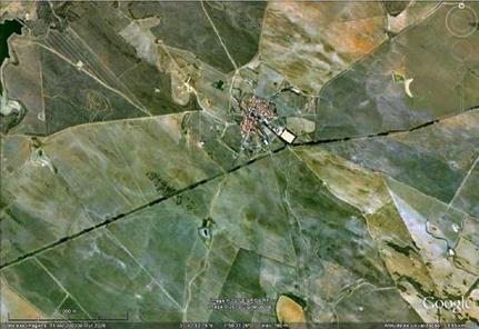
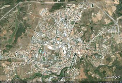
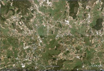
In the ‘identification guide for urban areas’, Google earth was used as an universal tool of easy and simple use in order to find examples of consolidated urban and rural settlements (high/medium or medium/small density of building fabric inserted in the rural landscape) – figures 3 and 4 – as well as examples of scattered settlements (dispersed/diffused building fabric contiguous and directly related to consolidated urban settlements and dispersed/diffused building fabric not contiguous to consolidated settlements) – figures 4 and 5.
|
|

|
|
|
|
Source: Google Earth Fig. 6. Example of a scattered settlement (dispersed/diffused building fabric) not contiguous to consolidated settlements: Avintes. |
In what concerns ‘identification guide for non-urban areas’, the first variable taking into account was orography – on a national scale, the main distinguishing factor to consider is the terrain. Four macro units were identified:
Unit 1 – Prevalence of landscapes with very rugged topography, i. e. valleys and hills with slopes and significant variation in height
Unit 2 – Prevalence of moderately hilly landscapes, i. e. valleys and hills with moderate
slopes and variation in height
Unit 3 – Prevalence of mostly flat landscape
Unit 4 – Landscape with very diverse orography, being present moderately rough and flat reliefs, with a strong component of urbanization and infrastructure.
The objective of mapping these units (figure 7) is to provide guidance for the identification of each of these types of orography, identifying the prevalence of each one of them in the different regions of the country. It should be mentioned that the Portuguese landscape is very diverse, with large variations in orography within a short geographical area – therefore it was decided to choose to identify large patches where such a geographical predominance is found.
The second variable taking into account to ‘identification guide for non-urban areas’ is vegetation, considering its higher or lower capacity of visual absorption. In this case a land use map should be employed and the following types are considered: [11]
3. Sparse woods, scrubland, meadows, low annual crops (e. g. cork oak and holm oak open woodland (montado), arable crops).
4. Permanent crops, planted in line (e. g., vineyard, orchards).
5. Open water landscapes (e. g., lagoons, estuaries, reservoirs and large rivers)
|
Fig. 7. Map of the orographic units for landscape integration of electrical infrastructures |


