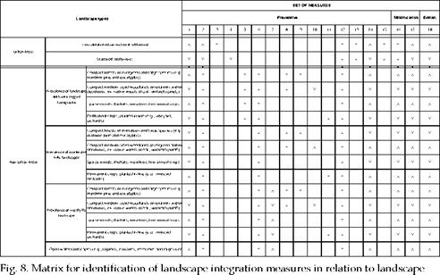
Having identified the type of landscape, it is possible to identify, through a guideline, the landscaping integration measures to consider in every situation. These measures are organized taking into account technical reasons, but also the process of planning and design of the company. Consequently, groups of Preventive Measures, Minimization Measures and Enhancement Measures were organized (figure 8).
|
|
Preventive Measures are used primarily to support the development of new projects, namely the layout of transmission and distribution overhead lines and the siting and implementation of substations, transformer stations and distribution cabinets. These strategic measures focus on large scale questions with a wider but integrated eye on the landscape. They are based on a macro view of the landscape, focusing on its organization and its biophysical components.
Minimization Measures apply both in existing situations and in new situations, after the consideration of the preventive measures. They aim to mitigate the impacts that infrastructures can cause, nevertheless, on the landscape. They are based on a micro view of the landscape and they focus on the physical and cultural components of the landscape. They aim the very specific integration on the ground and, as such, actions can impact both in terms of infrastructures and in terms of landscape through earth modelling, planting schemes, physical treatment of infrastructures, among others.
Enhancement Measures reflect the added value that the implementation of an infrastructure can bring, in terms of landscape. In other words, the infrastructure should be regarded as something useful or interesting to users of that landscape, through the inclusion of the social, environmental and visual purposes.
1.1 Preventive measures: Planning and design of the layout of infrastructures
Fifteen sets of Preventive Measures were considered, which are shortly described as follows:
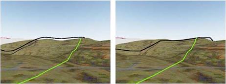
• Set 1 – General measures for all infrastructures: they refer to issues related to preliminary studies of landscape, namely the analysis of the planning instruments of the territory, the detailed survey of the intervention area (terrain, type of land use, land cover, natural and cultural values, roads, existing overhead lines and other infrastructures), the production of studies on view-sheds and 3D simulation projects, among others (fig.9).
|
Fig. 9. 3D simulations for different line designs |
• Set 2 – General Measures for transmission and distribution lines: it includes examination and evaluation of the best solutions, based on studies of visibility from the main access points since landscapes with greater capacity for visual absorption should be considered as preferential for the implementation of lines. At the same time, landscapes with high scenic and natural/cultural values, namely those with a high degree of integrity and conservation, should be kept free of overhead lines.
It is also considered using the same pole as support for multiple distribution lines or for various infrastructures, namely telecommunications.
• Set 3 – Transmission and distribution lines in urban centers and rural consolidated settlements: consider placing the line underground_as a priority solution, particularly in heritage areas. When this is not possible, consider to associate the layout of the line with other linear infrastructures and preserve, free from infrastructures, the zone of visual influence of natural and cultural heritage elements.
• Set 4 – Transmission and distribution lines in scattered urban zones and peripheries of the consolidated urban areas: select the most infrastructure areas (predominance of roads, industrial areas…) for the layout of the line.
• Set 5 – Transmission and distribution lines in hilly areas: focus on the possible deployment in less illuminated slopes, avoiding the ridge lines.
• Set 6 – Transmission and distribution lines in valley areas: prioritize the layout in areas where the valley is more engaged, in other words at points of lower visibility, following the natural depressions so that they are concealed.
• Set 7 – Transmission and distribution lines in flat zones: take in account land use – if the line finds a forest patch, focus the layout on the inside of the patch; if the line finds a permanent crop area in line focus on the straight layout, following the linear array of the landscape; in the water landscapes, consider placing the line underground or using existing infrastructures over the water plan, e. g. bridges.
• Set 8 – Transmission and distribution lines in forest patches: focus on the crossing by stands of lower landscape quality, in particular, eucalyptus and acacia tree species, at the expense of forest patches of higher landscape value (visually and ecologically).
• Set 9 – Transmission and distribution lines in compact forests of evergreen and large species: the layout of the lines should follow existing forest roads or forest clearings; and also consider the use of off line easement areas; in the slopes steeper than 1:3, not considering paths perpendicular to the line of greatest slope (fig.10).
|
Fig. 10. Scheme explaining the preferable layout (left) of a distribution line in hilly landscapes – avoid perpendicular lines to the steepest gradient. |
• Set 10 – Transmission and distribution lines in compact medium-sized woodlands: safeguard the permanence of the existing vegetation in the ‘right-of-way’ areas so that the height of the pole should be as small as possible so that, together with the line, they have reduced visibility above the trees canopy.
• Set 11 – Transmission and distribution lines in agricultural areas of permanent crops: give preference to placement of poles along the lines of culture and paths since line design should follow the geometry of the fields.
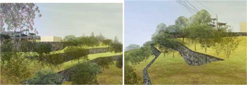
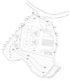
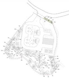
• Set 12 – General measures for substations: prioritize areas with land use with less visual and ecological value and in accordance with the topography of the place to minimize the areas of excavation and landfill; develop appropriate slopes to allow their landscaping with the use of vegetation; consider, in the purchase of land to implement a substation, a marginal area to develop a landscape project aiming its integration (fig.11).
• Set 13 – Substations in urban areas: consider the integration of substations in buildings and the construction of compact substations or underground substations; consider the possibility of creating a rooftop as an opportunity for providing space of interest for public use.
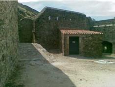
• Set 14 – General measures for transformer stations: consider the integration of transformer stations in existing built structures or attached to them, the incorporation in slopes or the combination with other elements of terrain modeling; consider the transformer stations as equipment subject to architectural design (fig.12).
• Set 15 – General measures for distribution cabinets: consider the establishment of cabinets on the walls of urban properties or on other structures, to avoid cluttering the sidewalks; consider the distribution cabinets as equipment subject to architectural design.
|
|
|

![]()
(c) (d)

